
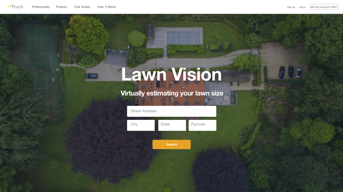
For my senior year project, I collaborated with three peers on a sponsored project with Porch.com to build a lawn care calculator that estimates your lawn size based on images of your lot property using Google Maps and Computer Vision.
Porch's business structure estimated the price of a lawn care job by using lot size as a favorable variable. In many cases Porch was over and under-estimating price quotes and thus losing potential customers. I collaborated with members in Porch's Design, Business Analysis, Data Science, and Development teams to understand the infrastructure we were building on and assess the business value of such a project.
Porch priced its lawn care jobs proportionally to a customer's lot size.
Working with Porch's growth manager, Adam Guenther, to understand the strategy behind lawn care services it became apparent that we had to:
My role as a UX product manager: I collaborated with members in Porch’s Design, Business Analysis, Data Science, and Development teams to understand the infrastructure we were building on and assess the business value of such a project.
Jason Nutter served as an incredible and agile coach enforcing full scrum. I handled jira tickets, wrote acceptance criteria, managed a prioritized backlog, enabled the development team to pick up tasks, and scheduled weekly sprint planning meetings with our mentors at Porch thereby allowing for a self-organizing team.
Since this project was heavily an iterative CV algorithm research rendition, the design had to supplement and showcase this process in the most effective and seamless manner. I scheduled one-on-ones with Porch's Co-Founder and design director, Jake Cooney, to discuss their messaging, style guide, and design language. I created the front-end UI that is now live at Porch.com and a poster to accompany our showcase booth.
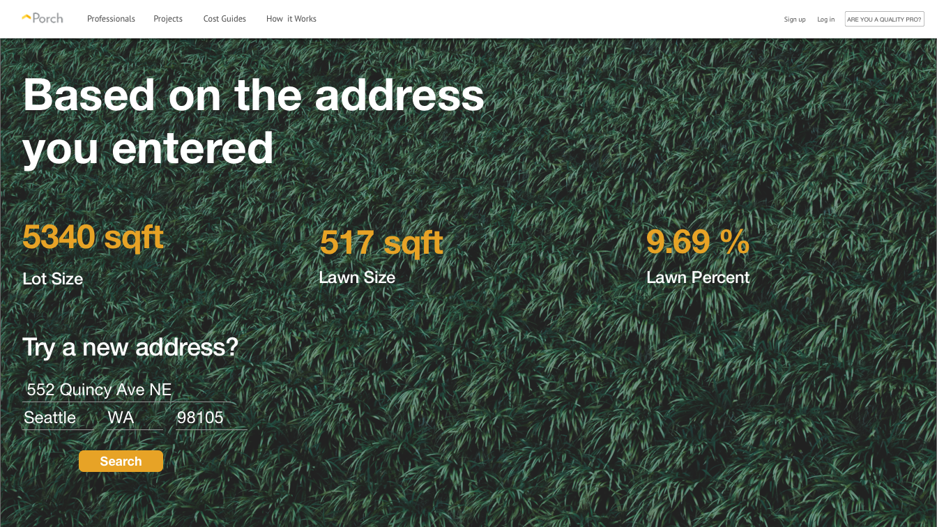
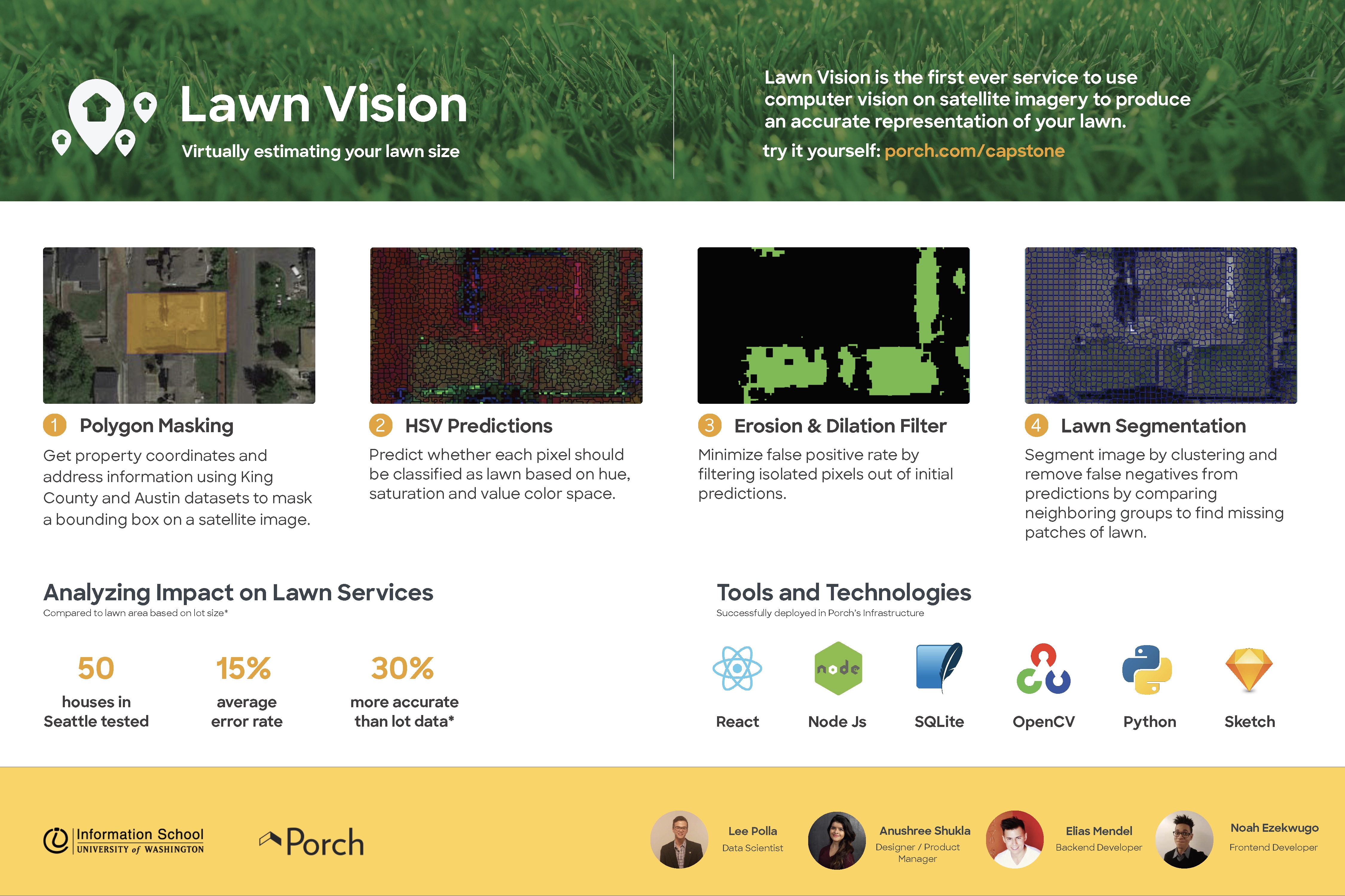
I worked with our data scientist, Lee Polla, to build a testing data set to accurately evaluate the effectiveness and accuracy rate of our product.
